Places · The mix-up that ruins an afternoon
Sea Caves in Cyprus: there are two of them, 200 km apart
Cyprus has two completely separate places called the Sea Caves, one near Peyia in the west and one at Cape Greco in the east, and they are nearly three hours apart. Here is how to tell which one you want.
- Filed under
- Places
- Updated
- 15 September 2026
- By
- The editors
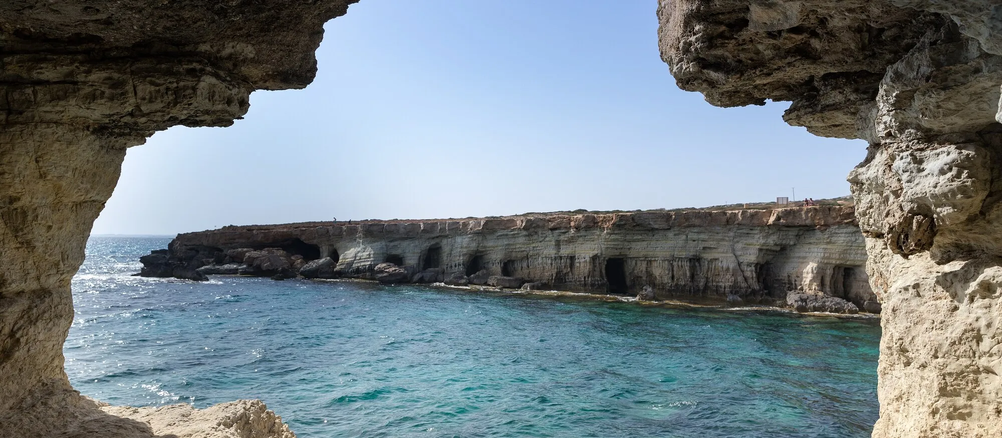
Cyprus has two completely separate places called the Sea Caves, and they are at opposite ends of the island. One is on the coast near Peyia, north of Coral Bay in the Paphos district. The other is inside Cape Greco National Forest Park, between Ayia Napa and Protaras. Driving between them is 200 km and takes close to three hours. If you have saved a photograph and assumed it is near your hotel, that is the fact to check first.
The two look alike in photographs, pale limestone and very blue water, but they make different days out. One has deep water that people swim and jump into. The other is a rock shelf where the sea is usually too rough for that, and where the real attraction is a rusting cargo ship.
Search results do nothing to help. The first page for “sea caves cyprus” carries two different Tripadvisor listings, one for each location, without either acknowledging that the other exists, alongside a boat tour for the eastern caves, a Facebook post about the western ones, and a Rightmove page selling property in a Peyia suburb that is also called Sea Caves.
Which Sea Caves do you mean?
| Peyia, Paphos district | Cape Greco, near Ayia Napa | |
|---|---|---|
| Where | West coast, north of Coral Bay | South east headland, between Ayia Napa and Protaras |
| Nearest resort | Coral Bay, 11 minutes | Ayia Napa 12 minutes, Protaras 11 minutes |
| From the airport | Paphos, 43 minutes | Larnaca, 58 minutes |
| Shore | Flat limestone shelf, no sand | Cliffs and cave mouths, no sand |
| Swimming | Usually rough, most people don’t | Deep, clear, popular, no lifeguard |
| The draw | The Edro III shipwreck and the erosion shelf | The cave openings themselves and cliff jumping |
| Marked trail | No official trail; informal rocky paths | Yes, 4 km linear, signposted |
| Cost | Free, no gate | Free, no gate |
| Tripadvisor | 4.4 from 481 reviews | 4.6 from 1,122 reviews |
The short version: if you want to swim, go east. If you want the shipwreck, go west. If you are staying in Paphos and someone has shown you a photograph of people leaping into turquoise water through a cave arch, that photograph is almost certainly Cape Greco, and it is a full day’s round trip away.
The western Sea Caves, near Peyia
These sit on the Akamas-facing coast north of Coral Bay, about 18 km and 29 minutes from Paphos harbour, or 6 km and 11 minutes from Coral Bay itself. From Paphos airport, allow about 43 minutes.
What you actually find is a low, flat shelf of pale rock that the sea has undercut into arches and hollows, with the water working away at it below. There is no beach and no sand. The ground near the edge is uneven and in places undercut, which is the main reason to keep back from it: the shelf is being eroded from underneath, and that is precisely what makes it photogenic.
Even the location is doubled. Mapping data returns two distinct points called Sea Caves in Peyia, one up at Agios Georgios and another closer to Coral Bay, several kilometres apart along the same coast. Adding to it, Sea Caves is also the name of the residential district on the clifftop above, which is why property listings keep appearing in the search results and why it turns up in our guide to the best places to live in Cyprus. If someone mentions living at the Sea Caves, they mean the neighbourhood, not the rocks.
The Edro III
The reason most visitors come is a cargo ship sitting on the rocks just offshore, tilted at eleven or twelve degrees and slowly going orange.
The Edro III was built in Norway in 1966, at Kaldnes Mekaniske Verksted in Tønsberg. She is over 80 metres long, somewhere around 2,300 to 2,500 tons, and was sailing under a Sierra Leone flag from Limassol to Rhodes with a cargo of plasterboard when she ran aground in heavy seas in December 2011. All nine crew, seven Albanians and two Egyptians, were airlifted off by a British military helicopter. Nobody was hurt.
The salvage that followed dealt with the danger rather than the ship. A Cypriot marine salvage company, working with the German firm CIMEXTA, removed the diesel, hydrocarbons and marine pollutants and made the hull watertight, finishing in October 2013. Towing attempts were abandoned as impractical, and there are officially no plans to remove her. Nearly fifteen years on she is effectively part of the coastline, and the single most photographed object on this stretch of the west coast.
Is it worth the trip?
It is worth an hour, not a day, and works best bolted onto something else. Time it for sunset: the wreck faces west and the light does the work, and a couple of clifftop bar terraces turn a fifteen minute photo stop into an evening.
Pair it with Coral Bay for the swim you cannot have here, or run north into the Akamas peninsula and on towards Lara Beach. One caution if you are planning that day: Avakas Gorge remains temporarily closed, according to the Visit Cyprus nature trails listing, despite a great deal of material online still describing it as open. Do not build the itinerary around it.
You need a car. There is no useful bus, and parking is informal ground near the cliffs rather than a car park, so our car hire guide is worth a look first.
The eastern Sea Caves, at Cape Greco
These are inside Cape Greco National Forest Park, a Natura 2000 site on the headland between the two big eastern resorts. From Ayia Napa it is about 7 km and 12 minutes; from Protaras, 6 km and 11 minutes. From Larnaca airport, allow just under an hour.
This is the version most people have in their heads: a run of white cliffs honeycombed with openings at the waterline, deep blue water directly below, and no sand anywhere. People swim here, and people jump from the rocks. It is genuinely popular and genuinely unmanaged, which is a combination worth taking seriously. There is no lifeguard, no marked entry point and no depth signage. UK Foreign Office advice for Cyprus notes that bathing is generally safe but that there can be strong waves and currents, and advises following warning signs and swimming only on approved beaches. This is not an approved beach. Judge the swell before you commit to anything, and remember that getting out of the water onto rock is much harder than getting in.
The official trail nobody mentions
There is a signposted route here, and the Deputy Ministry of Tourism publishes proper figures for it that no page on the first results page reproduces.
| Sea Caves to Agioi Anargyroi trail | |
|---|---|
| Length | 4 km, linear |
| Indicative time | 1.5 hours |
| Start altitude | 13 m |
| Highest point | 30 m |
| End altitude | 13 m |
| Start points | The Sea Caves, or Agioi Anargyroi church |
| Connects to | Konnoi to Agioi Anargyroi trail, and the Aphrodite Trail |
Seventeen metres of climb across four kilometres is the useful number: this is a flat coastal walk, not a hike, and the difficulty is the sun and the sharp limestone rather than the gradient. Much of it runs alongside the shoreline, crossing rocky ground with sparse salt-tolerant plants before turning inland through low scrub and a stretch of cereal fields. You pass the natural arch known as Kamara tou Koraka, the Bridge of Lovers, on the way.
It ends at the Agioi Anargyroi chapel, which is built directly over a sea cave where the saints it is named for are said to have lived as ascetics. That answers a question people keep asking about caves near Protaras: yes, there is one, and it has a church on top of it. About 200 metres west of the end of the trail there is a picnic site with drinking water, which is the only reliable water on the route.
The whole headland rewards more than a photo stop. Our Cape Greco guide covers it properly, and Konnos Bay at the western edge of the park is where to go if you want to finish the morning on actual sand. From the Protaras side, the Protaras beaches guide sets out the alternatives.
Can you actually go inside them?
Partly, and less than the photographs suggest. At both ends of the island you are mostly looking at the caves, from the clifftop above or from the rock at the water’s edge. Several of the best openings are only reachable by boat or by swimming to them.
Boat trips are the honest answer if you want to be inside an arch rather than standing above one. They run from Ayia Napa harbour along the Cape Greco coast in season, and on the west coast the same idea applies from Latchi, where the Blue Lagoon trips take in the Akamas coastline and its caves. A boat also removes the judgement call about swell, which on this coast is the part most likely to go wrong.
Getting the day right
Go early or go late. The middle of the day is the worst of both, hard light for photographs and no shade at either site. Cape Greco is busiest from mid-morning through the afternoon in summer; Peyia stays quiet until the sunset crowd arrives.
Wear shoes with a proper sole, because both places are sharp, uneven limestone and flip-flops are the common mistake. Take water, since there is none for sale at either, and take everything away with you: neither site has bins, staff or facilities of any kind.
Then check what you are looking at before you drive. If the picture has a rusting ship in it, you want Peyia. If it has people in the water under a cliff full of holes, you want Cape Greco. Nearly three hours separates the two, which is a long way to go to find the wrong coastline.
Hero image: Meereshöhlen von Ayia Napa by dronepicr, via Wikimedia Commons, CC BY 2.0. Cropped.
.jpg)
Quick answers
Frequently asked questions
Where are the sea caves in Cyprus?
There are two well-known sets, on opposite ends of the island. The western Sea Caves sit on the coast near Peyia, north of Coral Bay in the Paphos district. The eastern Sea Caves are inside Cape Greco National Forest Park between Ayia Napa and Protaras. They are about 200 km apart by road, which is close to three hours of driving, so it is worth checking which one a photograph actually shows before you plan around it.
Can you swim at the sea caves?
At Cape Greco, yes, and people also jump from the rocks there, though the water is deep, there is no lifeguard and no sand. At Peyia the water is usually rougher and the shore is a rock shelf with no beach, so most visitors look rather than swim and go to Coral Bay for a proper swim instead. UK Foreign Office advice for Cyprus is that bathing is generally safe but there can be strong waves and currents, and that you should follow warning signs and only swim on approved beaches. Neither of these places is an approved, lifeguarded beach.
Can you go inside the sea caves?
Only partly on foot. At both locations you mostly look at the caves from the clifftop or from the rock shelf at the water's edge, and some of the openings are reachable only by boat or by swimming. Boat trips run to the caves at both ends of the island in season, which is the easiest way to see them from the water without judging the swell yourself.
Are there sea caves in Protaras?
The Cape Greco caves are as close to Protaras as they are to Ayia Napa, roughly 11 minutes of driving from either. There is also a cave at Agioi Anargyroi on the Protaras side of the headland, where a small chapel is built directly above a sea cave that the saints it is named for are said to have used. The official Sea Caves to Agioi Anargyroi trail links the two.
Is there an entrance fee or parking at the sea caves?
Neither site charges an entrance fee and both have informal parking near the cliffs rather than a managed car park. There is no ticket office, no gate and very little signage at either, which is worth knowing if you are expecting a managed attraction. At Cape Greco there is a picnic site with drinking water about 200 metres west of the end of the nature trail.
What is the shipwreck at the sea caves?
That is the Edro III, a cargo ship built in Norway in 1966 that ran aground in a storm in December 2011 while carrying plasterboard from Limassol to Rhodes. All nine crew were airlifted to safety by a British military helicopter. Its fuel and pollutants were removed by 2013 and there are officially no plans to move the hull, so it has stayed on the rocks below the Peyia cliffs ever since.